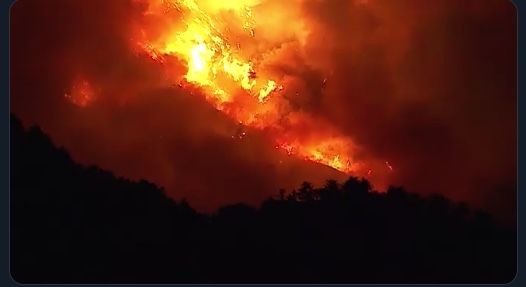
LA 역사상 최대 규모로 기록되고 있는 밥캣 산불이 갈수록 지역을 넓혀가며 거대해지고 있다.
이미 10만여 에이커를 불태우며 북동진하고 잇는 밥캣 산불 불길은 21일 오전 앤틸로프 밸리 지역 주민들을 위협하고 있다.
지난 18일까지만해도 80스퀘어마일이었던 밥캣산불 지역은 21일 현재 165마일로 2배 이상 규모가 커졌다.
10만 5,345에이커를 태웠지만 진화율은 여전히 15%에 머물고 있어 산불이 언제쯤 완진될 지 누구도 장담하지 못하고 있다.
소방당국은 진화 목표일은 10월 30일로 잡아놓고 있는 상태.
현재 밥캣 산불이 진행되고 있는 앤젤레스 내셔널 포레스트 지역에는 1700여명의 소방관과 227대의 소방차, 물탱크 차량 10여대가 동원되고 있지만 불길은 거세게 확산되고 있다.
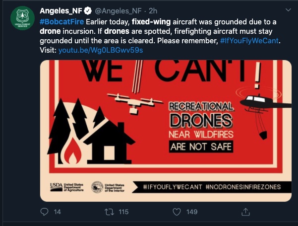
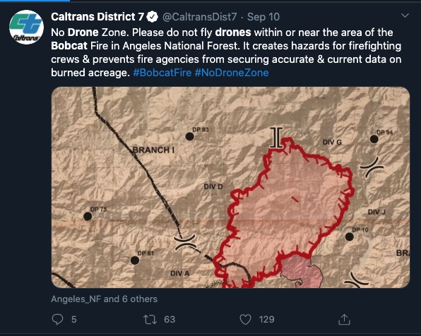
현재 소방항공기들은 시계가 불투명한데다 산불 지역 상공에 정체가 밝혀지지 않은 괴드론이 나타나 비행을 하지 못핸 채 지상에 묶여 있어 진화 작업을 더욱 더디게 만들고 있다. 이 지역에는 시속 30마일 속도의 강풍이 물고 있어 소방당국은 진화에 애를 먹고 있다.
불길은 풋힐지역에서 쥬니퍼힐스 지역으로 진행하며 확산되고 있고, 불길의 북쪽 끝지점에 해당되는 앤틸로프 밸리 지역이 위협을 받고 있다.<박재경 기자>
<밥캣 산불지역 대피령 현황>
🔺대피령 발동
-Angeles Crest Highway, between Angeles Forest Highway and Highway 39.
-Juniper Hills, Devils Punch Bowl and Paradise Springs.
– Crystal Lake, East Fork of the San Gabriel River and Camp Willams.
-South of Highway 138, north of Big Rock Creek, east of 87th Street East and West of Largo Vista Road.
-South of 138th Street East, north of Big Pine Highway and Highway 2, east of Largo Vista Road and west of 263rd Street East.
🔺대피경고
-City of Pasadena.
-Unincorporated communities of Altadena and Wrightwood.
-South of Pearblossom Highway, east and north of Angeles Forest Highway, north and west of -Mt. Emma Road, east and south of Highway 22 and west of Cheseboro Road.
-South of Highway 2, north of Blue Ridge Truck Trail, east of Highway 39 and West of the Los Angeles County border.
-South of Avenue U-8, north of East Avenue W-14, east of 121st East and west of 155th Street East.
-South of Pearblossom Highway, south and east of Pearblossom Highway, north and west of Mt. Emma Road, north and east of Angeles Forest Highway and west of Cheseboro Road.
-South of Mt. Emma Road, north of Upper Big Tujunga Canyon Road, east of Angeles Forest Highway and west of Pacifico Mountain.
https://youtu.be/HT1jSh72TyI


